
Videos
STFPD11 Uses WeatherStudio
Hurricane Tracking in WeatherStudio
Radar Loops in WeatherStudio
Images of WeatherStudio Version 2
(Version 1 plus much more)
Click Here for screenshots from Hurricane Isaac
Click images for full size
Extratropical Storm |
NAM Future Reflectivity |
Norwegian Storm with METAR obs and GFS wind speed data |
Tropical Formation Probs with Invest Systems and Invest Forecast Models* |
County-based Advisories with METAR obs Radar |
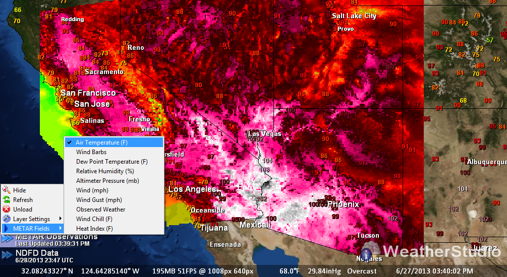
High-Resolution Background Orthoimagery*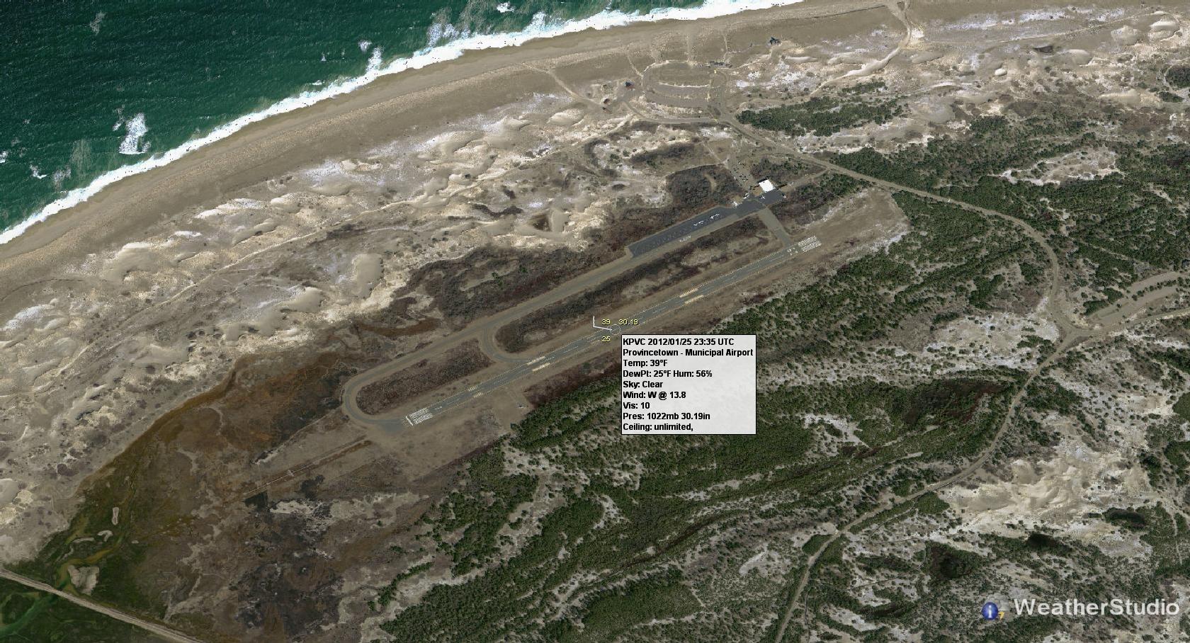 |
Street Level Mapping |
Convective Available Potential Energy (CAPE)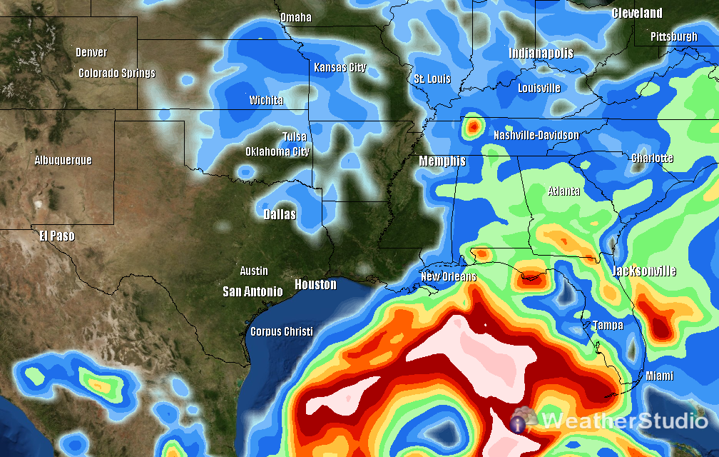 |
Severe Weather Warnings, Watches, National Radar, IR Satellite and METAR Wind Barbs |
Surface Analysis and County-Based Advisories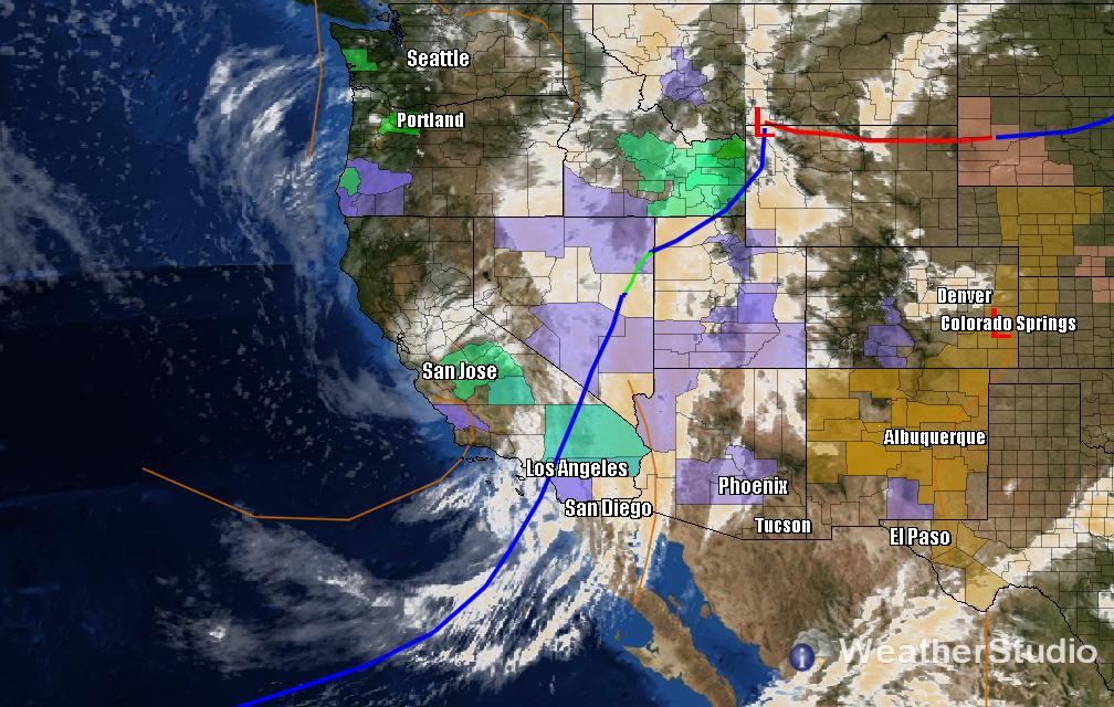 |
High Resolution Visible Satellite Imagery |
750mb Temperatures |
Precip-Typed Winter Radar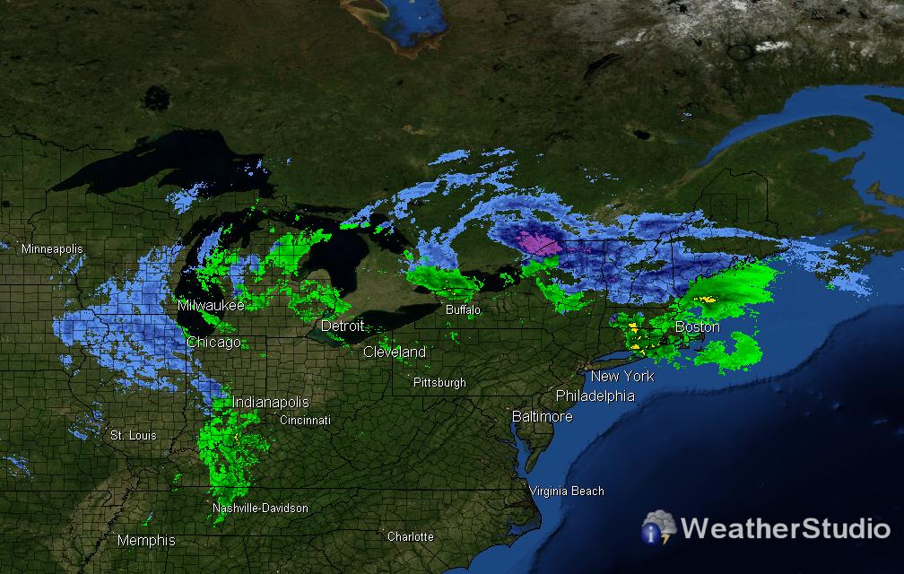 |
Probabilistic SPC Convective Outlook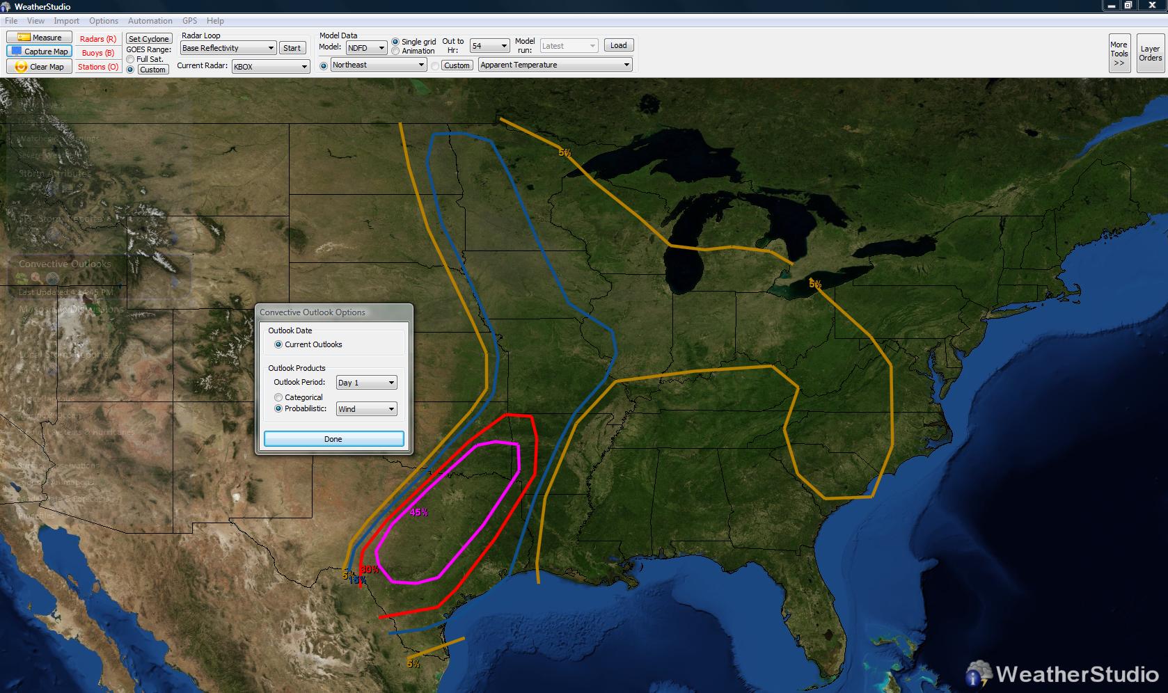 |
National Radar, Severe Weather Watches, and Placefile Data |
RUC Surface Dewpoints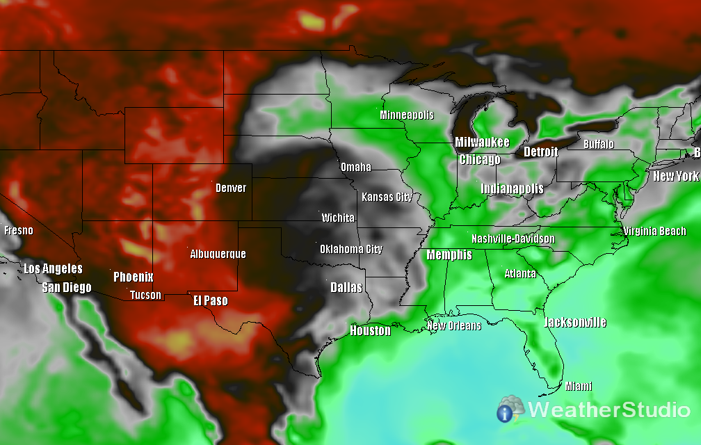 |
Severe Weather Outbreak |
GFS Precipitable Water (Entire Atmosphere) |
Hurricane Alex Landfall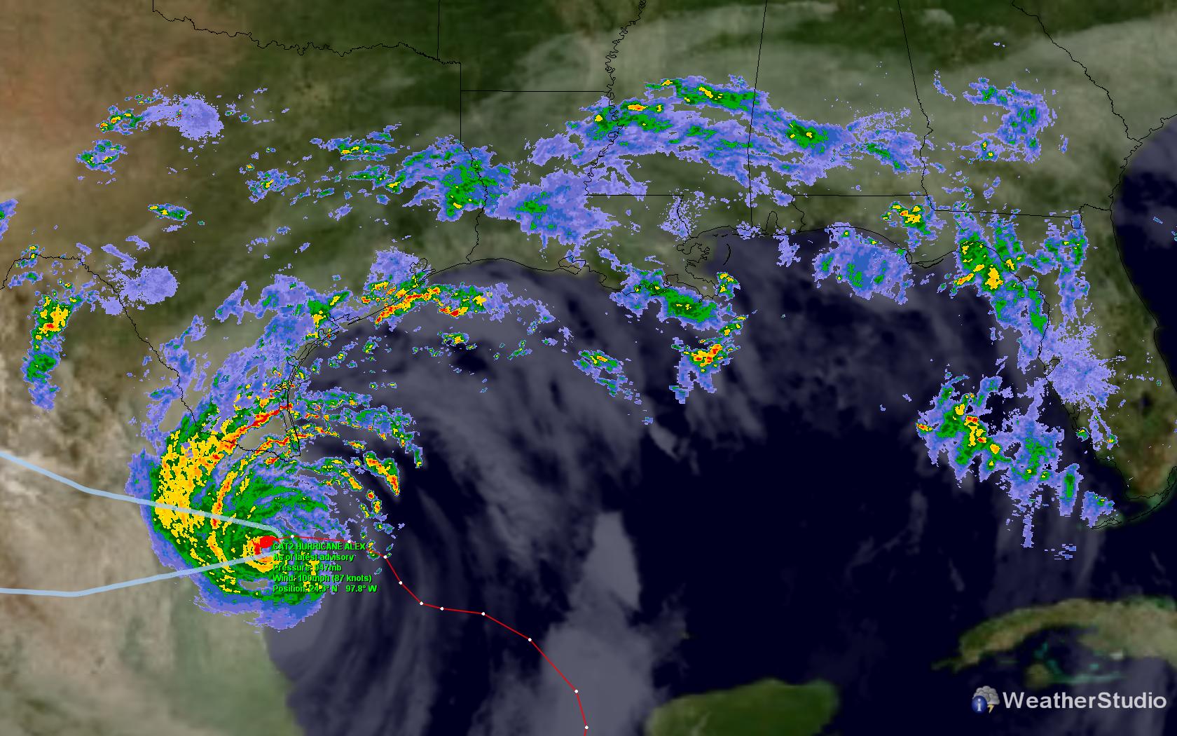 |
GFS Relative Humidity |
National Radar, Severe Weather Watches, and Placefile Data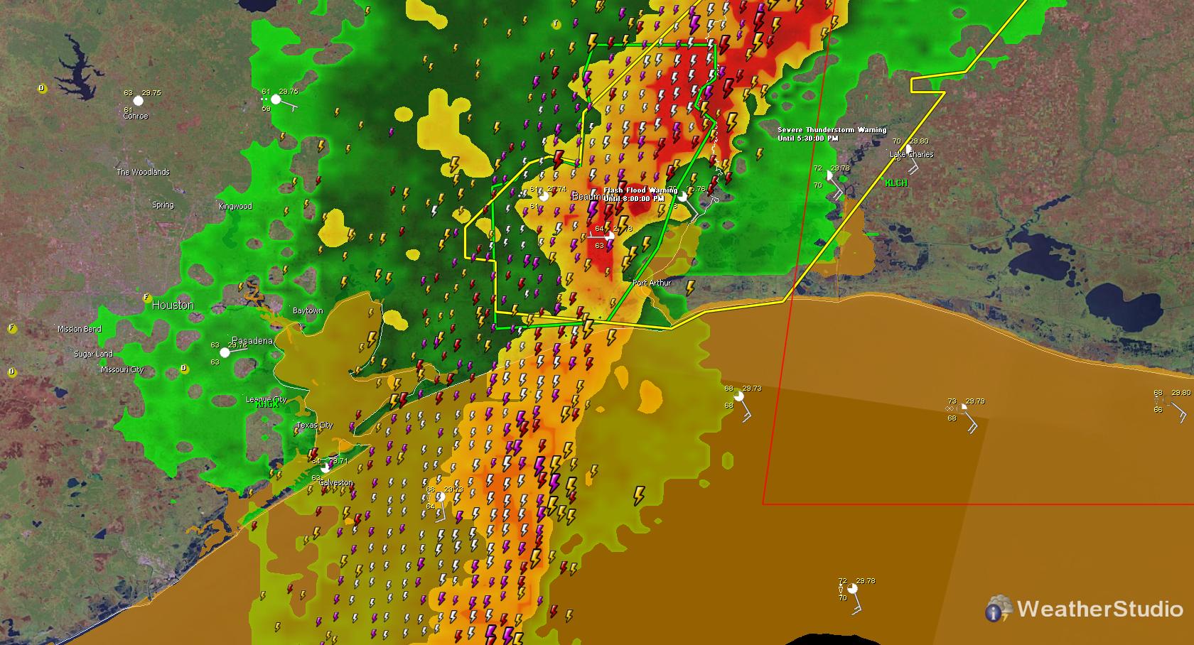 |
Invest Systems, Invest Forecast Models, Formation Probs |
National Radar Composite |

Images of WeatherStudio Version 1
Click images for full size
Hurricane Bill |
Tornado Watch |
Tornado Warning |
Cold Front |
Satellite |
Temperatures |
Sea Surface Temperature (SST) |
Convective Outlooks |
Buoy Explorer |
Hurricane Katrina Landfall |
Weather Conditions/Forecasts |
Mesoscale Discussion |
National Advisories Explorer |
METAR Station Plots |
Storm Paths |
Radar Product Menu ; ; |
River Observations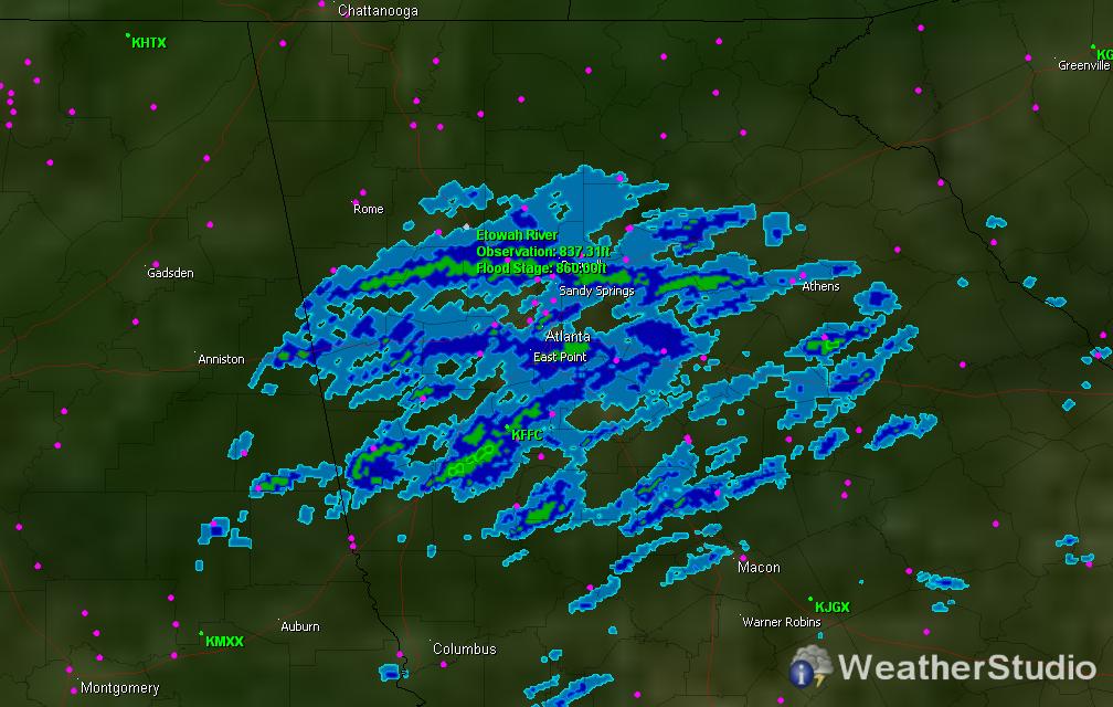 |
Hurricane Alex Radar Loop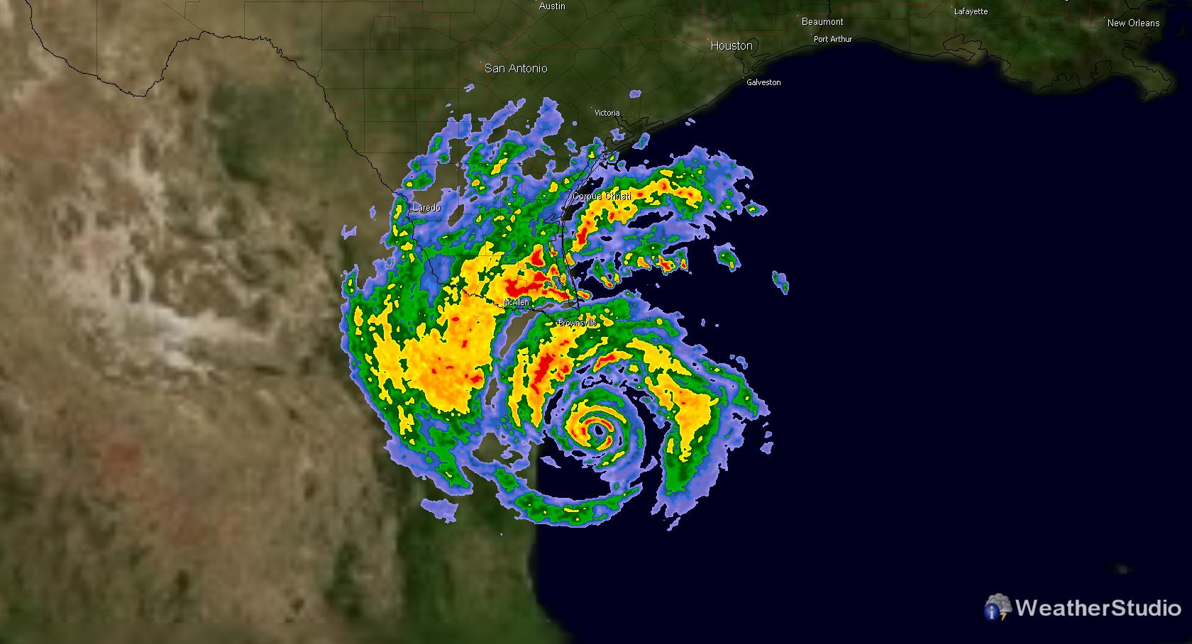 |
Measure Distances |
Sea Ice |
Ship Observations |
Hurricane Tracking |
Severe Weather Warnings |
Ocean Wave Heights |
Ocean Winds |
Visible Satellite |
View a longer list of features >>